

Showcase
Senter camera combines Avia LiDAR with visualization features for accurate and efficient monitoring of power lines
2024-3-21To guarantee the safety of power lines, functions that enable smart and remote inspections, corridor visualization and centralized data management are of great benefit. To this end, Shandong Senter Electronic Co., Ltd has launched the V4R box camera, a high-precision LiDAR and real-time visualized monitoring solution equipped with the Livox Avia LiDAR, which can deliver significant improvements in efficiency and accuracy.
Power line corridors are the lifeline for China's energy supply, meaning safety is of the utmost importance during operations and maintenance work. In recent years, China's electricity consumption has exhibited a clear “dual-peak” pattern in summer and winter, placing great pressure on the electricity grid. Areas surrounding power lines are becoming increasingly complex, with increased risks caused by obstacles and construction sites.
Traditional power line visualization devices primarily utilize images and videos. However, these devices are unable to accurately measure the distance between obstacles and power lines and trigger constant alerts, making it difficult to satisfy the high requirements of power line inspections.
To guarantee the safety of power lines, functions that enable smart and remote inspections, corridor visualization and centralized data management are of great benefit. To this end, Shandong Senter Electronic Co., Ltd has launched the V4R box camera, a high-precision LiDAR and real-time visualized monitoring solution equipped with the Livox Avia LiDAR, which can deliver significant improvements in efficiency and accuracy.

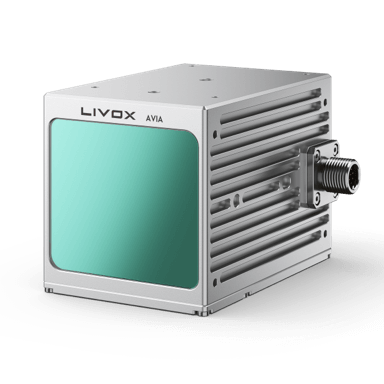
Senter has released the V4R, a box camera equipped with the Livox Avia LiDAR
Combination of visualization and high-precision LiDAR
The Senter V4R box camera houses a LiDAR module and an image acquisition module. With the help of point cloud distance measurement, AI recognition, point cloud image processing and other modules, the camera can accurately measure the distance from obstacles, identify changes in terrain, monitor power line sag and detect tree heights.

The V4R uses a combination of visualization and LiDAR point cloud technology

The V4R uses a combination of visualization and LiDAR point cloud technology
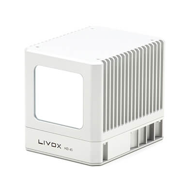
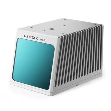
What's more, the V4R comes equipped with a Livox Avia LiDAR, which boasts a sampling rate of 240,000 points per second and can range long distances up to 450 meters. It can also obtain yaw-pitch-roll data, position data, LiDAR point data and video data, ensuring that obstacles are detected accurately with no details left uncaptured.

High-precision LiDARs help the camera to "see more clearly"
Tasks:
Efficient, high-precision detection and monitoring Tiered alert system
Traditional visualization devices present numerous problems for monitoring power lines. For example, a typical power line with around 30,000 sets of traditional visualization devices generates over 1.4 million alert images every week, all of which must be reviewed one by one—a very inefficient process. Moreover, due to the lack of a quantitative analysis function, these systems are unable to accurately identify the risk level, which makes it difficult to determine the correct course of action.
V4R LiDAR-enhanced box cameras can measure the clearance between obstacles and power lines with better accuracy and efficiency, allowing for quantitative analysis. In addition, the cameras can also be used to create a tiered alert system and reduce false alerts.
A tiered alert system can divide alerts into two different tiers based on the distance between obstacles and the power line.
· Tier-1 alerts are cautionary alerts, indicating that the obstacle poses a major risk to the power line.
· Tier-2 alerts are informative alerts, indicating that the obstacle poses a minor risk to the power line.
Depending on the alert level, an appropriate course of action can be determined to keep the power line safe.

LiDAR-enhanced monitoring devices can provide tiered, more accurate alerts
In addition, the system can also leverage the high-precision LiDAR measurement data and automatically filter out false alerts, which greatly reduces the human workload and enables real-time monitoring of the safety areas around power lines.

False obstacles and valid alerts
In a region with 30 sets of online devices without LiDAR ranging, approximately 10,000 alert images are generated every month, nearly 6,000 (60%) of which are false alerts.
After deploying LiDAR devices and enabling the tiered alert function, the system can set customized alert thresholds based on measured target distances and filter out 3000 false alert images. The new system not only frees monitoring staff from conducting laborious tasks, but also significantly improves the timeliness and effectiveness of alerts, thus enhancing the safety and reliability of the power lines.
Application: Obstacle distance measurement, high-precision galloping monitoring and sag monitoring
The V4R's combination of LiDAR and visualization functions enables the system to establish range detection models for conductors, ground, obstacles and other objects in power line corridor settings and accurately measure the distances between machinery, trees and power lines, which makes it possible to perform quantitative analysis of obstacles.
When obstacles are likely to damage the power line, the system will promptly give alerts and notify relevant personnel to respond in a timely manner. This combination of real-time monitoring, accurate measurement and preemptive alerts can significantly increase the accuracy and timeliness of obstacle monitoring and improve the efficiency of centralized monitoring by grid operations and inspection team.

Machinery identification and distance detection

Tree distance detection

Ice thickness detection

Power line galloping monitoring
In a nutshell, the Senter LiDAR box camera is equipped with cutting-edge features like three-dimensional positioning, range detection, sag measurement, and tree detection, which enable real-time monitoring of power line obstacles. A particular highlight is the high-precision on-board LiDAR sensor, which greatly improves the monitoring accuracy and minimizes the human workload.
This solution is poised to fuel the digitalization of power line systems, improve centralized monitoring by grid operations and inspection teams, and ensure the safety of power line operations and maintenance.

Livox Technology Company Limited (Livox) is an independent company founded through DJI's internal incubation program and dedicated to the development of 3D lidar technology.
Livox was founded in 2016 with the resolve to break through technological barriers in the lidar industry and reduce the threshold for mass production by producing high-quality, reliable, and cost-efficient lidar sensors that can be applied in a wide range of fields, including the automotive industry, smart cities, surveying and mapping, and mobile robots.
Over the past few years, Livox has applied for 587 patents for its unique sensor designs and rotating mirror hybrid solid-state lidar technology. Since the Mid product series was rolled out in January 2019, Livox has served more than 1500 customers, from 26 countries and regions, including the United States, Canada, China, Japan, and the European Union.